Main frame water design tactics need to be high on the priority list when starting any new project. The first thing we think about when considering whether to buy a property, develop a property, or rehabilitate a property has to be water design.
Conventional water design assumed large amounts of fossil fuel for operation and maintenance so it was mostly oriented around draining water away as quick as possible. But since our primary purpose is to harvest and put to work all the natural energy passing through our property that we possibly can, our water designs will look quite different from those that treat water as a problem.
Many of these older designs would fall apart quickly if the lights went out and the pumps stopped running. So it becomes the responsibility of the Permaculture Designer to find ways to sustainably manage water resources.
In the I Ching, the well is the center of the village, the center of life, the first important item to look for when considering a new settlement. This wisdom is still appropriate today, and applies whether structuring the ponds and swales of a 1000 acre farm, or a 1/3 acre lot in suburbia.
Certainly most places will have infrastructure and natural features that may complicate the issue, but whatever the situation, water is always the defining characteristic of production and life. As such, it needs to be first on our list when starting any project.
This is the design I submitted in my 2014 Permaculture course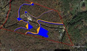 The red lines are boundaries,the black line a driveway and the yellow lines are dams and swales. The swale in it’s simplest form is a water harvesting trench on contour. It stops the flow of water downhill, and soaks it into the ground, or directs it sideways in very heavy rainfall. The incomplete swale in between the two major swales is a good example of working around existing infrastructure.
With large parts of the dam construction already accomplished, the design is well under way to completion. The dam and pond in the center of the photo has an arbitrary designation of HGP. Moving to the left is the Lower Gully Pond LGP, and following the contour there to the next pond is the Contour Pond.
Follow that same contour line to the very top of the photo at the boundary line and a small gully pond might normally be part of the design, but this is an example of running into the boundary and out of the designers’ control. A swale at this point can start to run uphill off contour along that boundary to control that water and channel it back into useful storage.
Or this might be a point where property owners might collaborate in building a dam to store and soak water, which might require some education and legal consideration to protect both parties.
The smallest pond between the Contour Pond and that shared pond is the Ridge Point Pond.
Currently it has been a dry summer and even though I held back a fair amount of water in the ponds since their creation in January, they are pretty dry right now. The original fish pond (not identified in the design) has the most water, primarily due to large releases from the LGP a few weeks ago when it appeared we might be getting some rain.
Lack of water at this stage doesn’t really concern me very much with respect to the success of the design since it takes about 7 years for a landscape to become fully hydrated. The HGP lost water quickly to the sedimentary rock with some clay that forms most of the pond area, and has no swales developed to add more water. Add to the natural losses the water I deliberately drained before the end of the rainy season and the current very low levels were really expected.
Even though it is down to a small fraction of the water it held back in the Spring, I know that “lost” water will continue to hydrate the surrounding soil and the existing pond life and other natural processes will start to form seals in the rock to slow the “losses” in future.
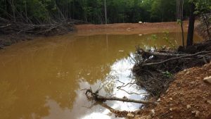 High Gully pond looking at dam
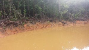 HGP looking toward the back at high water this Spring
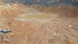 This last photo is recent, down to a foot or so of depth, but one good band of rain from a hurricane could change it all. Even just a couple inches to keep the catfish alive would help right now.
The Lower Gully Pond / Dam is just above the fish pond and has been the only partial failure in management thus far.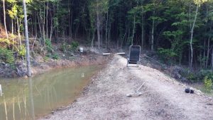
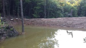
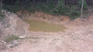 The trunk of the larger tree is immersed in the first two photos taken in June (left) – The last one taken in August after a final release of water into the fish pond. Note that tree is now high and dry on the far right center of the photo.
During the early Spring rains I was gone from the property for several major rain events in a row and the caretaker did not know how to open the drain valve or manage the water levels, and when I returned there was a partial breach that must have been somewhat forceful at first. Heavy rocks were moved at the waterfall going into the fish pond and there was some heavy erosion in the lower driveway from a sustained volume of water.
The net effect of the dams, however has been positive and overall the breach was mostly just a miscommunication, since it could have been avoided with proper management. The breach did affect how much water I felt safe in holding, so the rains that followed were kept well below the previous breach, even though a wheelbarrow and some time quickly repaired that small section.
For the long term, the goal is to have them self regulate with controlled/directed overflows taken away from the dam proper. Once dam height and width is to spec and swales are properly installed, the only thing that will breach the dam might be an earthquake or deliberate activity that compromises the features
Presently my work is to cut saplings, survey and generally get preliminary work done before renting the backhoe again, but like any good designer, I spend a lot of time doing observation–some might call it spacing out, but I have started to see a pattern developing since the dams have started to hold back “normal” water flows.
Looking forward to a time when the surface water storages are full, it becomes obvious that more will be needed and I’m looking at another swale a little above the level of the Fish Pond. I also see the potential for swales below the Fish Pond, but those may become part of a generational development not manifested all at once
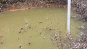 Early Spring- The PVC pipe has never been used but would be a drain if the pond ever needed cleaning. Note the water level is about a foot down in the picture above, but nearly full in this picture.
 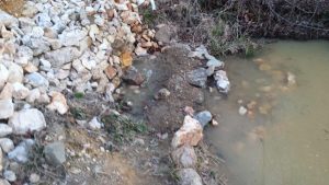 Waterfall supplying Fish Pond. the roks and gravel help with oxygenation.
Currently this area is covered with weeds, but somewhere in that gravel lined pool below the fall there are bulrushes and water irises.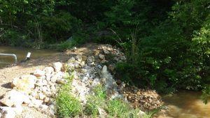 the proportions here may seem larger, but the fall is only about 4 feet high
 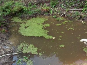 sediment pond that supplies the waterfall. In time I would hope this pond will stay full through the summer and be a source of duck weed which the gold fish eat to extinction. It can grow here then be released a little at a time through a drain that bypasses the waterfall
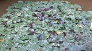 Water Lillies
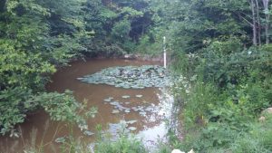
Note the few scattered Lotuses closer to the bottom of the photo that were planted at the end of last year, they are now threatening to take over the pond
Water Plants can be quite useful providing shade keeping the water cool, and also provide food for the fish. But in a pond like this small one, with so many fish and water levels reduced by half, they could block the surface area of the pond where oxygen is exchanged. Submerged plants actually consume oxygen at night and on cloudy days.
Some people forget that plant respiration goes one way in light, sequestering carbon and releasing oxygen, but then reverses at night, consuming oxygen and releasing carbon dioxide. Wild systems usually avoid this naturally, with continuous oxygenation from flowing water and various animals and fish consuming enough plants to balance the system. These gold fish, however, do not consume Water Lilies, and the deer have a problem accessing them.
The soil is mostly a sedimentary gravel/rock mix in both the Ridge Point and Contour ponds. This is both good and bad. Good in the sense that these ponds act as dry wells, pushing water underground , bad in the sense that they fill a little, then harbor mosquitoes for a while and empty, killing eggs and larvae of the critters that might control the mosquitoes in a more permanent pond.
The Contour pond currently gets lots of run off from the driveway, and suspended clay carried by this water has started to provide an effective seal. 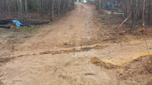 driveway with ditch leading to CP
 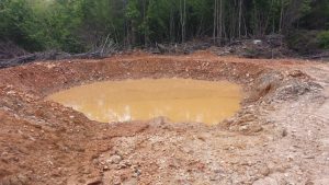 contour pond immediately after a heavy rain event
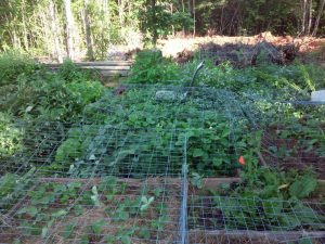 The Ridge Point Pond is located in the background upper right, and the back edge of the “pond” is basically described by the sunlight in front of the trees across the top of the photo. Mostly a dry hole now, the swale that is intended to supply it has not yet been connected. Even so, the rain has started the sealing process, and water that used to roll off the ridge now soaks into the ground. I’ll get more photos up when I find them.
The Ridge Point pond has an interesting place in this design, and will likely take longer to seal than the other ponds. It has the potential to act as the overflow drain for the whole upper part of the property, including not only its’ connected swale, but also overflow water from the cistern, and overflow from the High Gully Dam.
These “dry” holes, actually can become quite productive over time. Rice for instance only needs to be immersed in water early in its’ life cycle to control weeds. Taro can grow in water or very wet humus, likewise with Water Chestnuts and Kang Kong. The Circular nature of both dams lend themselves easily to a dome greenhouse structure covering them, creating a season extension. Having a direct access to water through poly pipe from the HGP, both the ridge Point and Contour ponds can be easily irrigated through the summer (Once that dam starts to hold a little more water.)
When dealing with something as expensive as a dam, it’s better safe than sorry. If you are thinking about building a dam, study, study, study. If you are trying to grow fish you will need to examine the soil and make sure the subsurface is not going to leak like a sieve. There are ways to overcome these sealing problems, but it’s good to know about them before hand.
I knew, for instance, the likelihood of a serious amount of rocky clay the farther I got out of the gullys. That expectation grew out of observation of a bench cut in the slope next to the fish pond. Seeing that type of soil disturbance can provide a great map of what to expect once you start to dig.
Under the accumulated clay that one would expect in a low spot or keypoint type formation in a gully there are a wide range of possibilities. Knowing the geologic history of the area can also help predict the soil types one might expect to find.
Still, these preliminary observations and research are no guarantee, and test holes will be the final judge of how a pond might work in any specific location.
Even if your primary goal is erosion control, and holding water in a pond is not a necessity, the Dam itself needs to have enough clay and a good construction. Hire an expert backhoe operator experienced in these constructions, or research carefully appropriate techniques for your area.
Well built and protected a dam will be there for a thousand years providing multiple benefits to the surrounding area with minimal maintenance.
I consider my dams to be erosion control, and was inspired after watching the torrents of water that would flow for days after a heavy rain running from the fish pond to the creek. This sort of erosion is actually normal here, and the excess water from my land was duplicated over and over up and down the creek, causing large flows that have washed away the bridge over a secondary highway several times.
These sorts of controls are desperately needed almost everywhere and while I may not prevent the whole creek from flooding, at least I’m trying to do my part to keep my land from contributing to the flood. Over time, if intelligent management becomes the norm, small ponds like these will be the best way to manage water. Large dams that flood whole regions have a host of problems, many of which are only now becoming known, while small ponds can become the life blood of an ecosystem..
One obscure bit of information I had never considered was reported in a survey and analysis that stated the hydroelectric power created by the large dams in the North West and Canada was not worth the lost fertility in the forest from the migration of salmon upstream from the ocean. Add that to the fact that many of these dams have silted up and are no longer efficient producers of power, or have deteriorated and become unsafe, and the net effect seems to indicate they should never have been built.
Small dams like mine are located in places those migratory fish would never reach directly under normal conditions. A small dam failure is of little consequence to the surrounding community, but contrast this with the huge amount of water sent downstream by the Army Corps of Engineers recently after Hurricane Harvey.
They had to release so much water to protect these large reservoir dams that many houses which had not been injured by the hurricane needed to be evacuated because of the man made high water from these very large dam projects.
As a conclusion to this water design post, let me include the newest project, the link provides a good theoretical and practical explanation of the process.
https://www.youtube.com/watch?v=bzaInlFVq0s
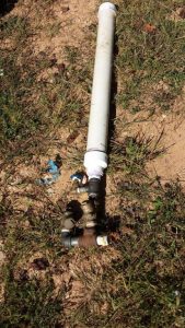
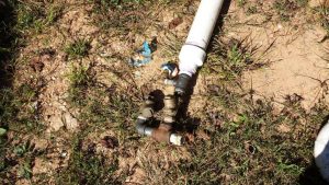
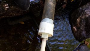 The creek already had a dam with a fiberglass 3 ” pipe going through the dam and yesterday I used a gutter adhesive to fasten this cleanout pvc fitting that has a threaded end to allow for easy changes in whatever attachments I might want to make to the water flow. In this case a 1 inch CPVC pipe
Normally it would be difficult and very expensive to buy assorted fittings to adapt to a 3″ thread. Lowes had nothing but the normal cleanout plug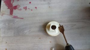 I found a drill bit that was almost a perfect size for the 1 inch pipe
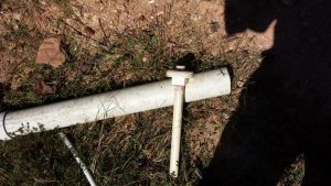 glued it in place and then screwed the assembly into the cleanout fitting.
 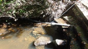 After I opened the water flow I did get the ram going, but after waiting overnight there was still no water at the fish pond. One mistake was not installing unions that would allow easy removal of the pump, because shortly after discussing the issue with a friend who had an operational pump, we decided the problem could be the lengthy supply line (150 feet).
Shortening that line gave me a slight water flow at the Fish Pond, but the reality of a short fall at the dam and the height to raise the water to coupled with the size of the pump meant it was really about as good as could be expected.
Some tips, if you try something like this, make sure your valves move very freely, friction, stickiness, anything that affects the reaction time of the valves could be the difference between a functional pump and a failed experiment.
A pressure gauge between the pressure tank and the output line may give an easier way to monitor the pump operation without running up and down the hill checking the output. In this case the operation of the “waste” valve is affected by gravity. A little experimentation and I found some slight adjustments in the vertical angle of that waste valve could speed up or slow down the rate of the ram action.
The new supply line is about 20 feet long, and the 1/2 inch output line was slightly longer but at almost the same elevation. Changing the rate of the ram action of the pump did not seem to have a large effect on the output, but a pressure gauge would probably help with finding the most efficient action of the pump.